

During my travels, I’ve been fortunate to see and experience much that is worth sharing.
My hope is that these images touch your hearts, much as the USA’s natural beauty has touched mine.
May the adventurous among you benefit from the travel information I share on these pages!
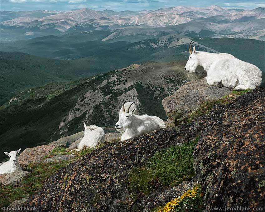
Mountain goats at Mount Evans — Click / tap image to view full size
Late in July of 2012, my son and I traveled to Mount Evans, a 14,264-foot peak located about 1½ hours west of Denver. The route is paved the entire way, ending just short of the summit, and happens to be the highest paved road in North America.
Though we did get to the summit, the highlight of our morning’s journey occurred on the way up, when we spotted a small herd of mountain goats right near the highway, at about 13,600 feet.
I pulled off the highway as far as I could—at that elevation, the pavement is narrow and shoulderless— grabbed my camera, and scrambled down the rock-strewn slope with my son. Thinking back upon it, as dizzy as I felt in the thinner air, I was fortunate not to have tripped over my own feet, to say nothing of all the rocks!
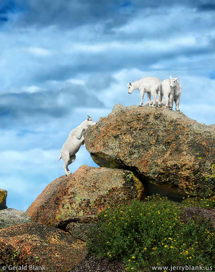
Young mountain goats —
Click / tap image to view full size
It turned out that there was no need to rush. We soon realized the mountain goats had chosen that spot to soak up the bright morning sun, and weren’t in the mood to move away just because some two-legged creatures wanted a closer look at them.
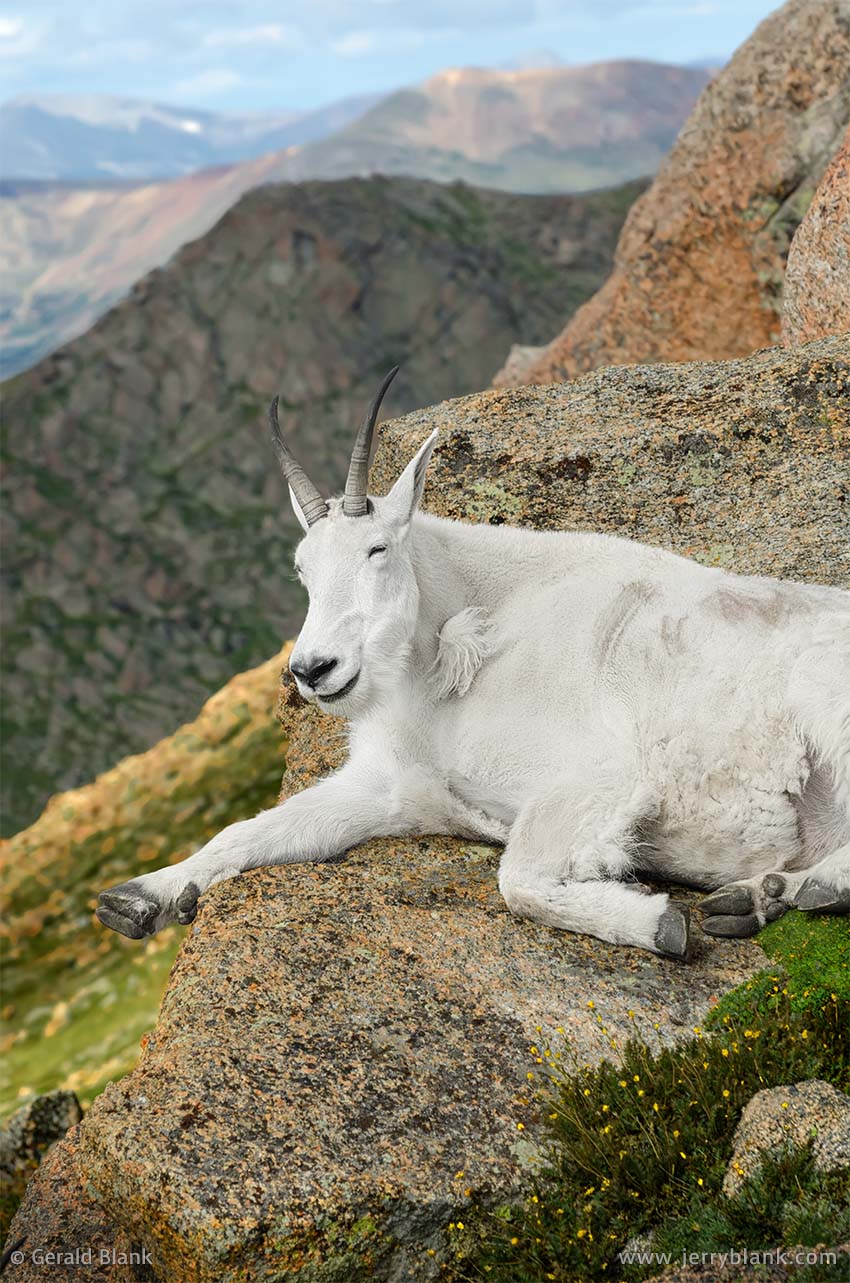
As you can see in these images, the goats were the picture of contentment; in fact, their expressions were amazingly humanlike when compared to animals I had seen on previous trips to the northern Rockies.
The goat herd was not large, but it did have many youngsters. There was a stiff chill breeze blowing down the mountainside, and four of the kids decided to tough it out atop a large rock by huddling together as close as possible.
Just chillin’ at Mount Evans —
Click / tap image to view full size
Nearby, a yearling paced to and fro at the base of another rock while working up the nerve required to leap up to join a couple of kids. As the yearling placed its small hooves against the rock, one of the kids was peering down at it. If not for the wind, I’ve no doubt I would have heard it telling the yearling to circle uphill around the rock, to access it from above as the kids had done. “Jumping’s too much work, you dummy! Go around!” Humiliated, the yearling found its courage and easily made the leap to the top of the rock.
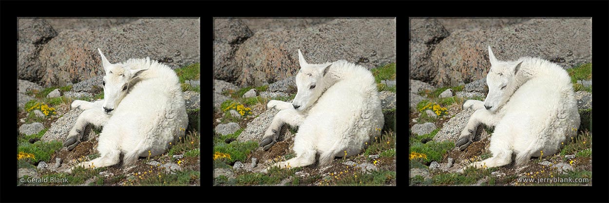
A mountain goat kid naps in the sun — Click / tap image to view full size
Meanwhile, the other kids in the herd rested with the grownups on the patchy tundra, in a small sunny space with a nice view of Mt. Bierstadt and the Abyss Lake drainage. Another kid napped near a less-exposed rocky niche as my camera clicked softly but steadily, capturing the scene.
While we avoided making sudden movements toward the herd, the experience was fun because the goats are used to gawkers and don’t mind being watched. That doesn’t diminish the respect I have for those who specialize in capturing wildlife images. We got lucky on that morning late in July. Good wildlife shots normally require a thorough knowledge of the animals and the paths they travel... and even more patience.
We did not take the time to visit the Echo Lake trail, down lower on the mountain, but it is also a great place to hike. We did, however, continue to the summit trailhead parking lot and climbed up the short trail to the peak. I’m glad we did... one can see miles and miles of the Colorado landscape when the weather is decent, from the Great Plains toward the east to Guanella Pass looking west.
Author’s note, November 2023: Mount Evans was originally named in honor of John Evans, as is the city of Evanston, IL. Evans was a respected physician, an inventor of medical devices, and a philanthropist who founded hospitals and universities in Illinois and Colorado. He was also instrumental in the construction of railroads linking the Rocky Mountain region to the eastern and southern United States.
By the mid-19th century, Evans’ railroad investments had made him wealthy, which increased his political clout in his home state of Illinois. He was an abolitionist, Republican politician, and friend of President Abraham Lincoln, who appointed him as the second governor of Colorado Territory. Not long afterward, Evans was faced with a choice: To betray a band of friendly native Americans, to whom he had pledged sanctuary, or to disappoint the white settlers of Colorado and endanger his chances of winning a seat in the U.S. Senate. He chose betrayal, which resulted in the Sand Creek Massacre of the native Americans.
The subsequent investigation shed light on the events leading up to the massacre, as well as Evans’ attempts to cover it up. Disgraced, his political career came to a sudden end. He was forced to resign as governor, and his Senate ambitions evaporated.
During the second half of his life, Evans fared better without political power and influence. It was, perhaps, his destiny to learn the hard way that true power comes from the human heart, and that all lives matter. He continued his philanthropic work until he died in the late 1800s. In honor of his accomplishments, Mount Evans was named after him.
On Sept. 15, 2023, the United States Board on Geographic Names chose to rename the peak to “Mount Blue Sky”, to appease the descendants of the Native Americans who were massacred at Sand Creek. This seems typical now: Over the past half-century, the federal government has chosen superficial measures, like changing place names, to make it seem like they’re doing the right thing by Native Americans.
In reality, though, federal policy intended to help native tribes was flawed from the beginning, and still is. The status quo isn’t a good thing. In fact, it’s helped to keep native Americans in the skids for the past century. Few, if any, federal officials have the willingness or the support to enact real reforms which could encourage Native Americans to stand on their own feet and learn how to prosper in 21st century America. Still, that's the only way forward. There’s no easy way out.
Renaming places after a century has come and gone is expensive and impractical. In 2023, the adjacent Mount Evans Wilderness was not renamed. The Wikipedia article about “Mount Blue Sky” has pictures of “Mount Evans”; the signage in the photos is expensive, and replacing it takes time. Changing history seems difficult, only until we finally accept that it’s impossible. It was what it was.
Sanitizing every mention of “Mount Evans” can’t be fully accomplished online, either—too much information has been written and stored. Decades from now, older sites will still be calling the place “Mount Evans”. This website probably won’t exist in a few decades. As far as I’m concerned, what I wrote in 2012 was true then, is true now, and need not be revised.
Personally, I’m a fan of native American spiritual beliefs. As a boy, I was an Indian Guide before joining the Cub Scouts. Mount Rainier has a special place in native American culture and in my own heart—and my heart calls Rainier by its original name, “Takhoma”. The pioneers who came to Washington state before me gave it another name, and it is what it is. I won’t start campaigning to change the names of any mountains—even the ones I don’t care for—because those places are in many hearts other than mine.
↑ RETURN TO MAIN MENU AT TOP OF PAGE ↑
During my son’s 2012 summer vacation, we spent a few days exploring Rocky Mountain National Park, Colorado, and lodged in nearby Estes Park. After my son went back home to Minnesota, I returned to Estes Park to explore the Colorado Rockies for a few more days.
By that time, I had gotten into a routine of awaking about 5 a.m. and hitting the trail while it was still relatively quiet and cool. During the summer tourist season, the trailhead parking lots in Colorado’s scenic areas are filled before midmorning!
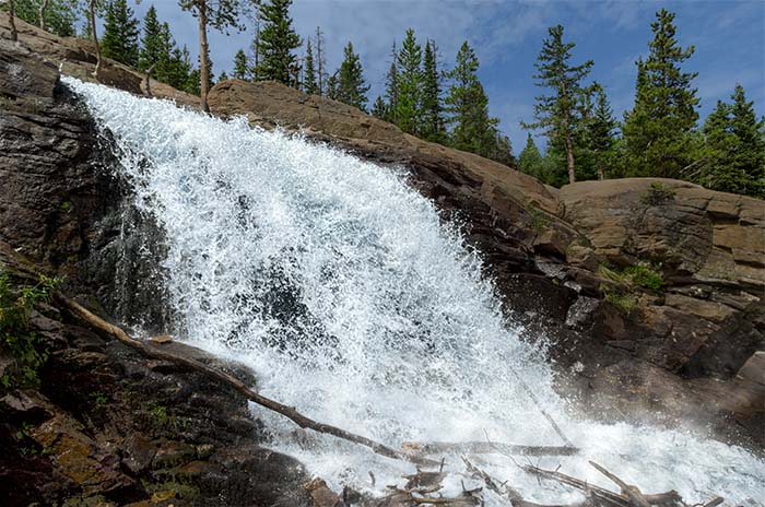
The lower falls
While I enjoy company while on a long trail, I found I also enjoyed the experience of being alone on the trail at dawn. The morning of August 2 was just such a day. There were few cars at the Glacier Gorge trailhead when I arrived, and shortly after I began my hike, I noticed a couple of bull elk strolling through the aspen groves and munching contentedly on mushrooms. As the trail angled upward, I lost sight of the elk and paused to sit on a rock to record the sounds of the awakening forest with the external microphone I’d attached to my camera.
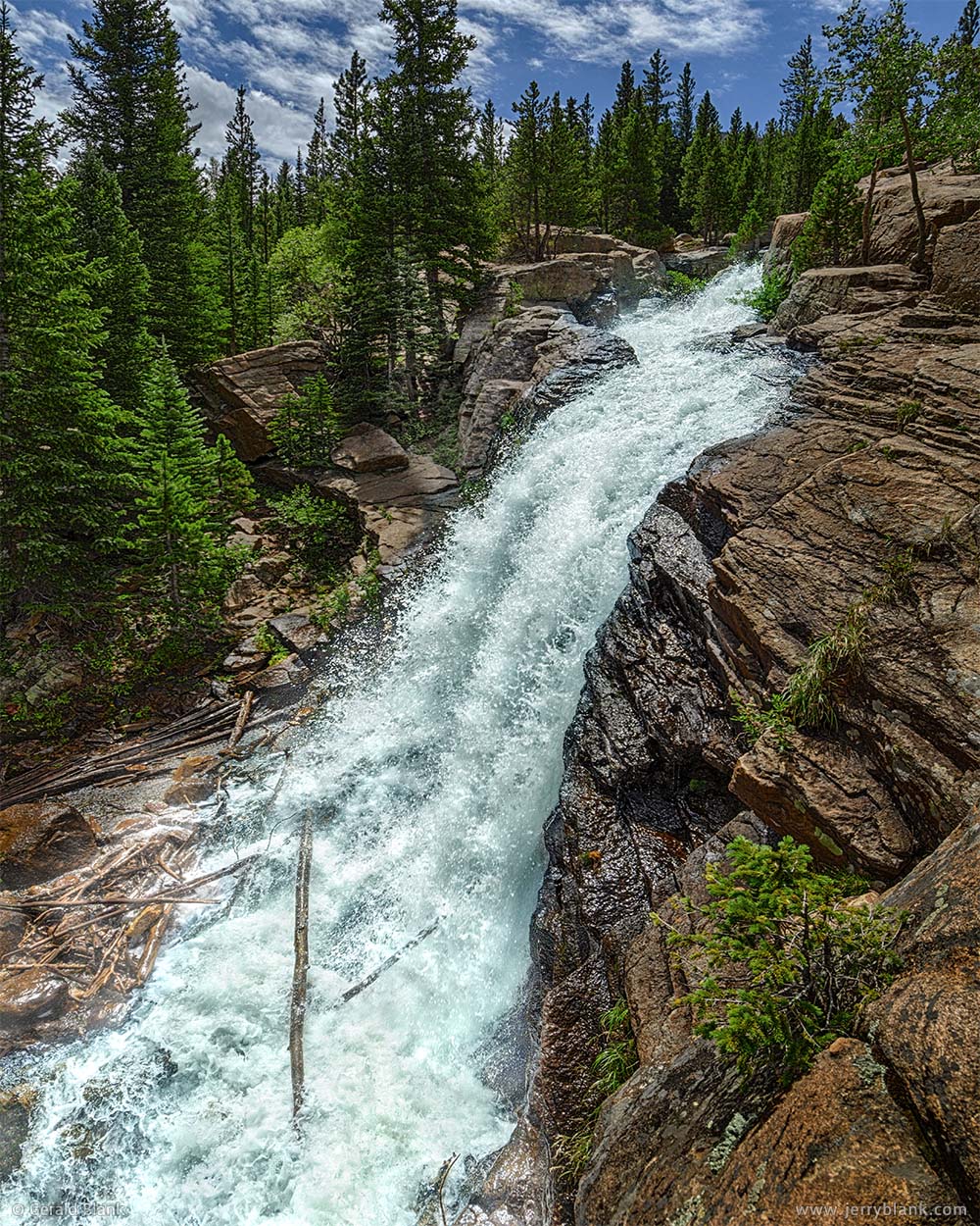
A side view of the falls
When I returned to the trail, I spotted the elk briefly once again, and arrived at Alberta Falls a short while later. There were patchy clouds in the morning sky, which turned out to be great; it afforded me an opportunity to capture both still images and video at the falls in a wide variety of lighting conditions. After shooting from the west side of the gorge, with other hikers and photographers, I decided I really wanted to try shooting the falls from the east side.
Fording the creek seemed tricky—but that turned out to be a rush to judgement on my part.
At that time, the Park Service had built no foot bridges near Alberta Falls—and there’s no telling if they ever will. I considered taking a short hike above the falls to find a better place to ford the creek... but decided instead to skip the hike and to try rock-hopping below the falls. Unfortunately, I underestimated the weight of my backpack and overestimated my jumping skills.
I did make it across the creek, but not before stumbling into the drink about halfway across. With no other hikers within earshot, all the rude comments I blurted out were carried downstream by the swift waters as I clambered back onto my feet and finished my hop to the east bank.
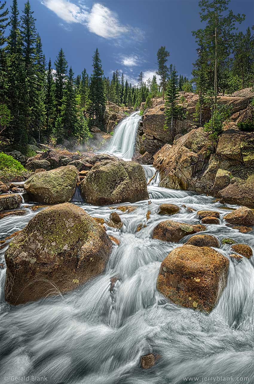
Alberta Falls — Click / tap image to view full size
My camera equipment didn’t get dunked—which was the important thing—but my clothes were wet. By the time that thought crossed my mind, I noticed a hooded sweatshirt hanging from the branch of a fir tree, not far from the creek; an item left behind during someone else’s adventure. Though faded and frayed, it was just my size, and was dry and warm. With gratitude, I pulled off my wet shirt and replaced it with the hoodie. With that done, I unpacked my camera and began to take in the scene.
How can I share the experience of feeling all that water crash down to the rocks at my feet, sending a cool mist of spray in all directions? It was one of those “you had to be there” moments. But I liked the idea of digitally freezing a few tons of splashing water into a moment of time, so I took several pictures like the first one in this post.
By that time, it was midday. The light of the high sun isn’t usually desired by outdoor photographers, but it worked well for the image I wanted to convey to those who couldn’t be there. I was standing across from a natural channel cut into the granite by the rushing waters—a process which may have only taken moments from the water’s point of view, but many of our lifetimes. The channel resembled the curve of a waterslide, but for some reason none of the nearby hikers attempted to ride it down. While reflecting on that, I captured the second image displayed here, again using a high shutter speed.
Satisfied that I had done all I could from the east side of the waterfall, I scrambled up to the granite ledge I’d chosen to use as a clothes dryer, and put my shirt back on. I climbed up a little farther to survey the creek above Alberta Falls—which I ought to have done in the first place—and found three fallen tree trunks lying across the creek, forming as perfect a bridge as one could expect to see on a mountain trail. With a rueful chuckle, I crossed the bridge to the west side and made my way back down to the falls while making a mental note to exercise more patience in the future. Patience pays off! I was lucky that only my ego had been bruised on the boulders at the base of the falls that morning.
After a couple of hours of shooting the falls from every possible angle, the sun was fairly high and was shining brightly on the cascade. It’s often hard to take good photos of waterfalls surrounded by trees in direct sunlight, but I decided to try a series of half-second and one-second exposures, which typically give moving water a “flowing” effect. To avoid extreme overexposure in the sunlight, I mounted a dark neutral density filter on my lens.
By the time I packed up my gear and headed back down the trail, the cool mountain air had warmed up considerably, and park visitors were heading uphill in droves to view Alberta Falls. I was happy to have started my day before sunrise, and happier still to end it with some nice images of the waterfall!
After returning home, I edited the image captured with the neutral density filter (the the third image displayed in this post), and applied a software HDR filter to create a more “painterly” effect in the foreground. I left the background alone for the most part, but reduced the brightness of the sky enough to keep the viewer’s attention on the flowing water.
As for the hoodie... I brought it with me on many more hikes over the next few years. I didn’t mind that it was a bit tattered when I found it, but by 2016 I decided it had lived a good, long life and that I could replace it with a new one.
↑ RETURN TO MAIN MENU AT TOP OF PAGE ↑
The Maroon Bells–Snowmass Wilderness of Colorado lies in the White River National Forest, south of the ski towns of Snowmass and Aspen, and its star attraction is a pair of peaks named the Maroon Bells. The Bells form a photogenic backdrop when viewed westward from nearby Maroon Lake. This, in addition to the easy access to the wilderness, makes the Maroon Bells the most-photographed mountains in Colorado.
Images of the Bells towering 4400 feet over the lake have been captured by millions of visitors. Over 100,000 visitors travel to the Maroon Lake trailhead, about 13 miles south of Aspen, every year. Aspen is on Colorado Highway 84, and the most direct route is via Interstate 70 to Glenwood Springs. Those traveling west to Aspen via CO 84 get there by crossing Independence Pass, which is one of the many scenic byways in the state.
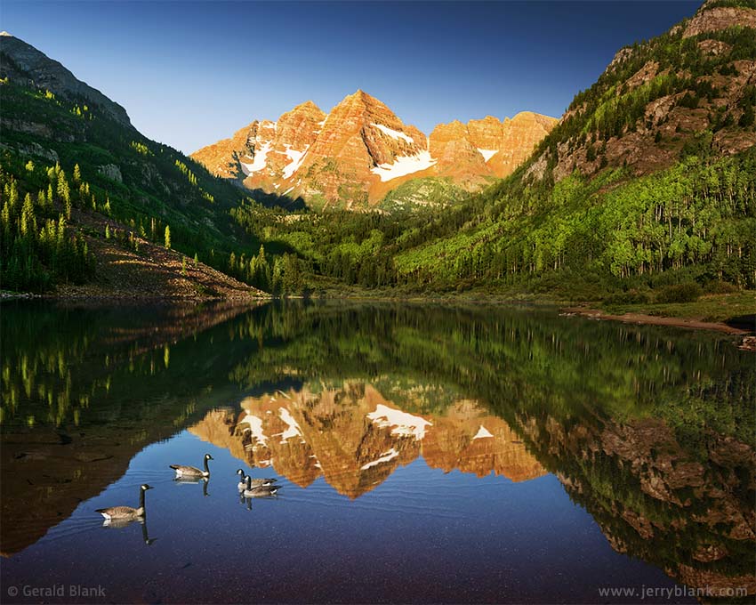
The Maroon Bells after sunrise — Click / tap image to view full size
Arriving at Aspen early one summer afternoon, I discovered the parking lot at the lake had filled up hours earlier, but that one could purchase a shuttle bus ticket at Aspen Highlands, 8 miles north of the trailhead. The bus ride was slow, bumpy, and hot, but the destination is well worth it.
Once there, I saw what I had guessed at before arriving: The best sunlight for capturing an image of the Maroon Bells would be in the early morning. It is not rocket science; if one does an online search for photos of the Bells, the most striking images are either “moody” settings with the peaks surrounded by cloud formations, or they are captured on clear mornings when the peaks are bathed in sunlight from the east.
I followed a popular trail on the north side of the lake, which crosses into the wilderness and leads to Crater Lake. Whenever I reached an open space, I gazed around the valley to get a feel for the place, and wondered what uniqueness I could lend to an image of a scene which had been captured masterfully by many folks already.
The only sure thing was that no competition existed between myself and the other travelers in whose footsteps I was following. Artists capture beauty as seen through their eyes, and sharing it with others is its own reward. Competition springs from a “survival of the fittest” instinct, and has no place in the creative process.
My intention was to revisit the lake the following day, but I was unsure what the next day would reveal. I was only certain that I would need to awaken at dark o’clock to arrive at Maroon Lake when I needed to.
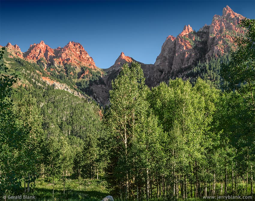
The spires of Sievers Mountain rise 3000 feet above the trailhead
The following morning’s drive from Snowmass Village through Aspen was dark enough, but the glow in the eastern sky brightened swiftly as I made my way south past Aspen Highlands to Maroon Lake.
This time, the drive was quiet, peaceful, and cool. By then I had learned how things work in Colorado’s summer recreation areas: The early bird gets the parking spot. And no matter how early one arrives, one will find a few parked cars at the lot, belonging to earlier birds.
I had arrived on time, as I had hoped, but not too early. The sun was beginning to rise in the east and was already setting Maroon Peak and North Maroon Peak aglow in the distance, as I set up my camera alongside a lake still in the shadow of Pyramid Peak.
There were but a few other hikers near Maroon Lake... nothing like the throngs of people I had seen the day before. There were also some other two-legged creatures nearby: Canada geese, making the most of an opportunity to poke around in the shallows before a thousand other folks like me would appear.
That is how Divine Providence helped me to capture a view of Maroon Lake I consider to be unique. There are many images of the surrounding valley filled with wildflowers, and even more images of happy sunburned vacationers by the shore of the lake, captured by proud parents or grandparents. But good pictures of critters visiting Maroon Lake can’t be set up. One must be lucky enough to cross paths with them.
Many mountain formations in this corner of Colorado are composed of reddish mudstone, which is how the Bells got their name. Their natural color is overpowered by the warm glow of sunlight in the image I captured above, but a close look at the lake bottom reveals it is covered with small gravelly pieces of the same maroon-colored rock.
Above the Maroon Lake trailhead near the parking lot and bus stop, the spires of Sievers Mountain South rise 3000 feet above the valley floor Sievers Mountain is part of the Elk Range, which for the most part is made of the same red rock as the Maroon Bells. I took a photo of Sievers Mountain about an hour after my arrival. By that time, the sun was shining on the valley, and though it still had a warm tinge, one can better see the magnificent reddish tones of the Elk Mountains.
On my second visit to the Maroon Bells–Snowmass National Wilderness Area, I arrived even earlier, and captured images entirely different than the ones pictured here. Click/tap here to read the next chapter of the story...
↑ RETURN TO MAIN MENU AT TOP OF PAGE ↑
The old mining town of Crystal, Colorado is fairly well known as a tourist destination to people familiar with Glenwood Springs on Interstate 70, and with the smaller towns southward along State Highway 133, like Marble and Crested Butte. Despite its high elevation (nearly 9000 feet), Crystal boasted 400 residents 150 years ago.
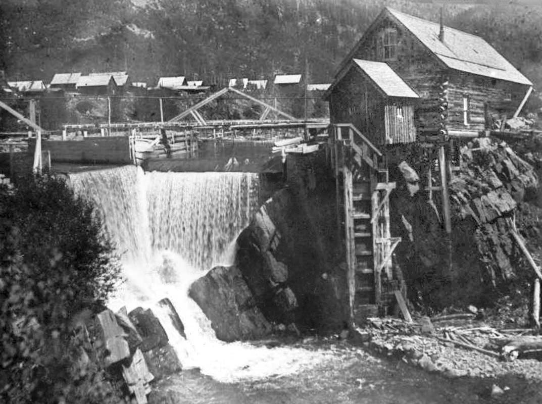
The mining camp at Crystal
Today, only a handful of old-timers call it home in the summer months, and the forces of nature have covered over what remains of 19th century buildings and mining structures. One outstanding exception is the Crystal Mill, which is on the National Register of Historic Places. It survives because of the dedicated volunteers who do repair work on the structure every summer.
The mill is perched above a bend on the aptly-named Crystal River, with Crystal Peak serving as a scenic backdrop. The smaller shed extending from the larger log wall building was, actually, not a mill. Instead, it housed a horizontal waterwheel coupled to an air compressor; the compressed air powered machinery in the nearby silver mines.
Though the building itself appears to have changed little since the mining days, the surrounding neighborhood has been transformed by Time from an unsightly collection of wooden buildings, flumes, and mining contraptions into a tranquil mountain scene flanked by aspen trees. The Crystal Mill is undoubtedly one of the scenic jewels in the Colorado Rockies—but getting there can be tricky if one is not prepared.
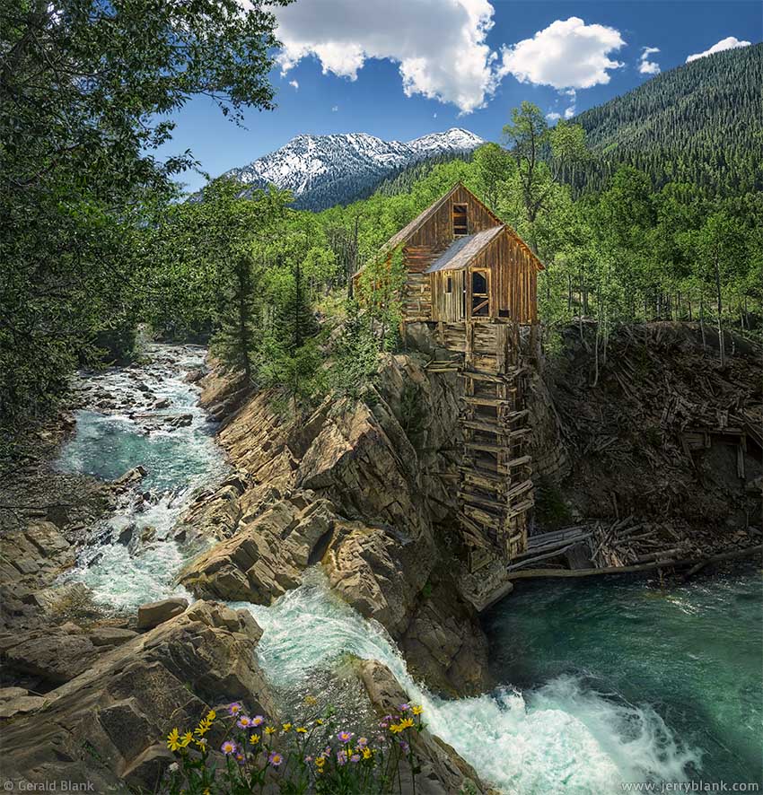
Some things get better with age, like the Crystal Mill — Click / tap image to view full size
The mill can easily be viewed from Gunnison County Road 3. CR3 is listed clearly on the Colorado road atlas as well as online maps, but road maintenance consists of clearing fallen trees and rock slides in the spring. Gunnison County road graders don’t touch it. It may have been appropriate to call CR3 a “road” 150 years ago, when a road was something one usually traversed by horse and cart. You can probably already see where this is leading to...
The closest town of any size is Marble, a few miles northwest of Crystal as the crow flies. I observed that Marble offered ATV rentals and jeep tours, but I have driven my SUV on rough mountain roads many a time, only avoiding routes designated “4WD” on USGS maps or Forest Service maps (I quickly learned that “4WD” means “This road hasn’t been maintained for decades. Any vehicles larger than an ATV will get beat up”).
Following the Crystal River upstream on CR3, I soon found out the folks who draw the maps forgot to designate this road as “4WD”. The entire 4-mile route is one lane wide, if that; several stretches are too narrow for one car to pull over enough to let an oncoming vehicle pass. Instead, one of the two vehicles must back up to a wider spot. I got pretty good at driving in reverse, before I arrived at the Mill. Do not take your shiny new Hummer or Jeep to Crystal, unless you also intend to bring a chain saw and whack off every tree limb that’s long enough to scratch your paint.
In this respect, things were about the same during Crystal’s mining heyday; Crystal had no rail service. Sheep Mountain’s inhospitable geology made mule teams the most practical mode of transporting goods to and from Crystal—which, in turn, made silver mining less profitable than in other parts of Colorado.
Despite the harrowing drive, the destination is well worth the trip. During my visit, I sat on one of the large rocks pictured at the left side of the color photo, and slowly munched on a sandwich, taking in the pleasant sights and sounds. The noise of mineworkers and machinery washed down the Crystal River decades ago. Only the river speaks now, accompanied by songbirds.
The better images I have seen of the Crystal Mill appear to have been taken in early summer—when the aspens have just leafed out at the 9000 foot elevation—or at the peak of the fall color season. The light is most favorable in the early morning, when the sun rises enough to clear the high ridge on the east side of CR3. However, rules are made to be broken, and the sharply defined light of late morning served me well when I captured the image above.
One enthusiastic traveler told me I could continue on Forest Service Road 417 south to Schofield Pass. That trail offers excellent views of Emerald Lake and the Maroon-Snowmass Wilderness. The person who shared this information was, perhaps, not aware of the route’s history: There are an average of 17 serious accidents per year on the pass, with some fatalities in the mix. I learned those facts from DangerousRoads.org. So if I do consider visiting Schofield Pass in the future, I’ll re-read the DangerousRoads.org article first!